Venezuelan rock art has been a subject of multidisciplinary studies for years (e.g. Boulton 1993; Straka 1975). One of the defined cultural regions is the north-central area (Idler 2004, Páez 2012).
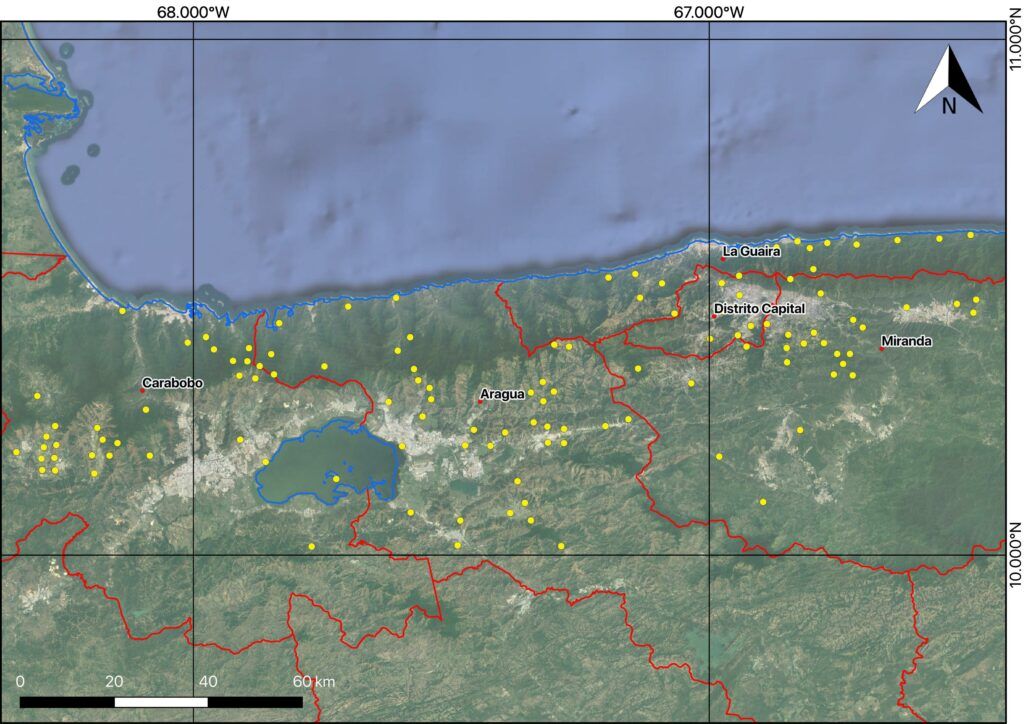
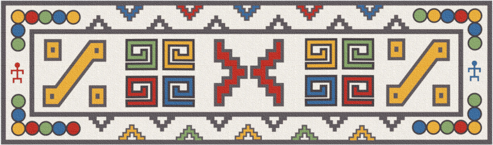
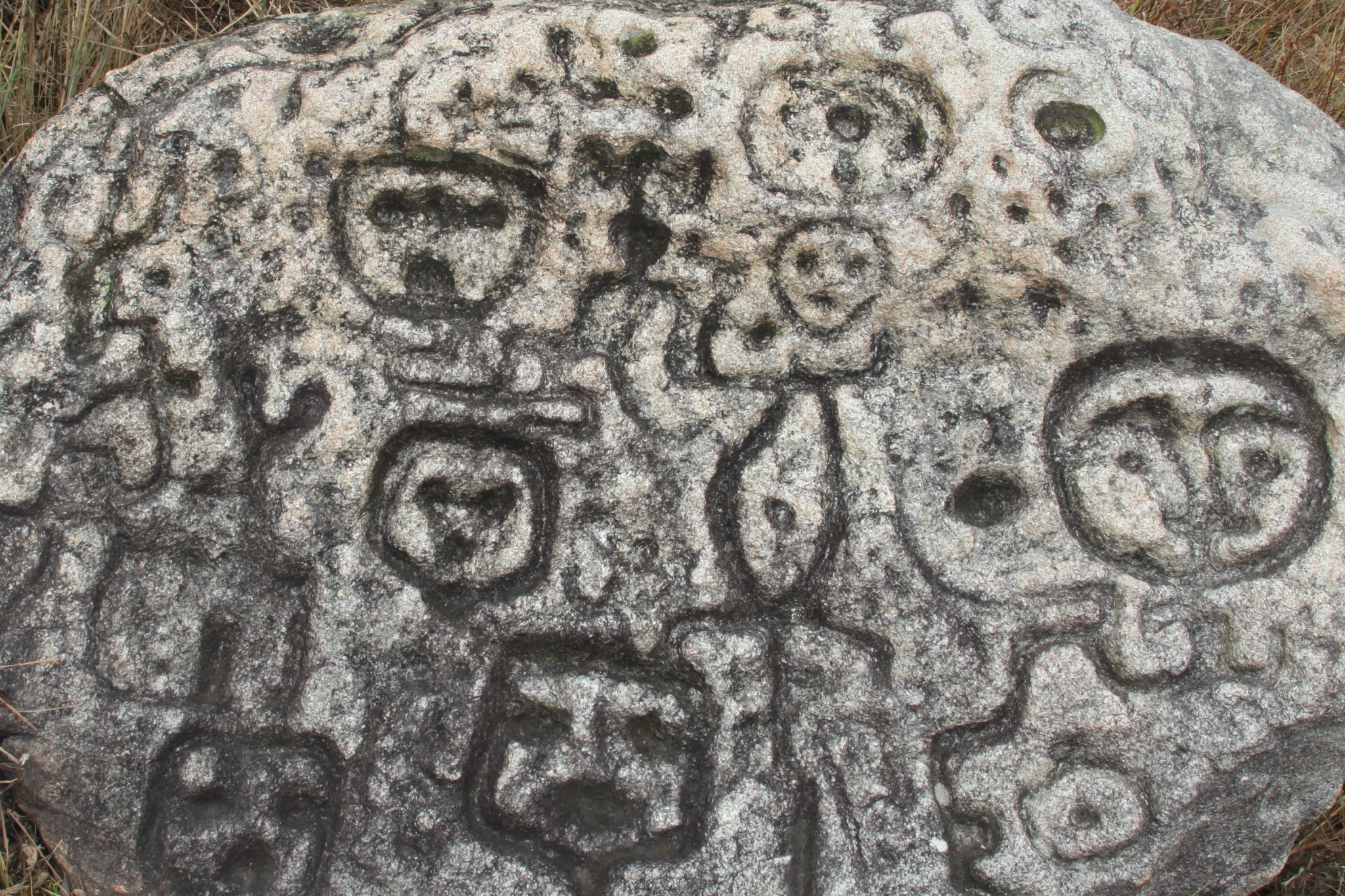
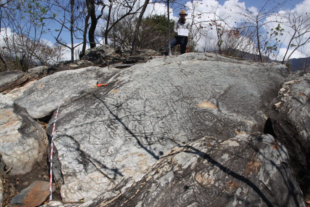
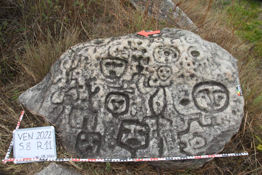
Many rock art sites with numerous petroglyphs were found in that region, and they are considered a part of the Valencia-style iconographical region (Falcon et al. 2000; Sujo 1975; Vargas 1985; Delgado 1989; e.g. Antczak et al. 2007; Jaffea 2018). In the late 19th century a few Venezuelan scholars (e.g. Marcano 1889) mentioned the presence of numerous “hieroglyphical inscriptions” in the northern region (Páez 2010), but unfortunately, this idea was abandoned by future researchers. The majority of the rock art studies concern registration of the petroglyphs, stylistic classification, and very rarely archaeo-astrological analyzes (Páez 2010; Falcon et al. 2000). Some of the researchers (Marcano 1971; Páez 2012; Cardozo 1987) tried to establish the relationship between indigenous petroglyphs and belief systems as they are expressed in the idea of the totem. Others even tried to analyze them as so-called toponyms (sic!) (Páez 2010, 2012). Nevertheless, this rich and promising area for a deeper analysis of GCS applied “on a stable ground” has not been studied until now by conjoining different perspectives.
The main goal of this subproject is to investigate the rock art GCS from the perspectives of archaeology, ethnology, history, and cognitive linguistics, with the methodologies used by other subprojects of this joined enterprise, in order to look for the meaning of the signs and their internal syntax. Other particular aims are 1) creation of classification of rock art signs from the emic perspective, 2) determination of particular signs and/or syntaxes as the concept vehicles, and 3) determining if the notation principle (Elkins 1999; Mikulska 2015) plays a role in the process of (de)coding the signs’ meaning.

The main hypothesis is that rock art constitutes a visual code of meaning (Rozwadowski 2009; Echevarría Lopez 2013, 2016; Páez 2012), so it can be treated as a GCS, with its repertoire of signs and syntax or inner logic. Nevertheless, instead of superimposing Western categories in order to classify the signs and look for their meaning in this way, the main assumption is that the native categories must be taken into account. The second working hypothesis is that the geographical distribution of the signs “on the ground” is at the same time made according to the notational principle, that is to say, part of the meaning is codified through the spatial reference between the signs.
The iconographic material –understood as rock art, but also pottery, colonial maps, and other “iconographical documents”– from the north-central part of Venezuela will be collected for the analysis. This part of the work includes fieldwork, research in the archives, and libraries, and collecting the published data. Then, all the iconographic data will be put into the GIS database which includes all information of the analyzed material (cultural affiliation, chronology, geographical location, the context of finding each of the rocks, and a particular type of sign). In the following stage, the typology of the signs will be elaborated. The main methodological tools used will be iconographic analysis (Panofsky 1975) and the cognitive approach (Lakoff & Johnson 1980, Evans & Green 2006). Then, the relationship among all the categories of signs embedded in the elaborated material will be looked for. The aim of syntactic analysis (Rozwadowski 2009) is to find syntaxes among individual signs. Furthermore, the notation analysis of selected signs/syntaxes will be conducted (Elkins 1999; Severi 1997). The arrangement of particular signs plays a significant role in the process of reading this kind of information. Moreover, the spatial references among the rock art signs will be compared with their geographical distribution in the studied region. Subsequently, all the results of previous analyzes will be compared to define the exact groups of signs that will be considered in further semantic analysis in terms of building communication models. This study will be led from the emic perspective based on the interpretative approach (Páez 2012), the cultural context of the discussed area, which is the base of all anthropological and cognitive linguistics (Godlewski 2008).
List of institutions/organizations that are involved in the subproject
- Universidad Central de Venezuela
- Instituto de Patrimonio Cultural de Venezuela